Sangiran is one of the villages in Kali Jambe sub-district, regency of Sragen, Central Java. It locates about 15 km north of Solo city. The name of Sangiran was chosen as a representative of those villages where within a single geological section we can find a succession of various hominid types.
Many scientists have undertaken an investi¬gation on Sangiran. Firstly, van Es in 1931 published the geological map of Sangiran. Later, in 1976 to 1979 the Indonesia-Japan teamwork carried out an extensive research on Sangiran not only in geological aspects but also paleontological aspects (such as to carry out a number of excavations) and dating (see Suzuki et.al. 1985).
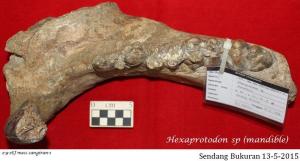
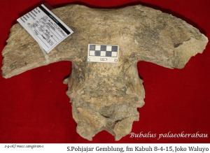
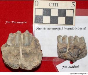
The sediments of Sangiran area form the structure a dome-like. Therefore, the area is commonly called as Sangiran dome (see Fig.1). There are four formations identified in this area, from old to young: Puren (Up¬per Kalibeng), Sangiran (Pucangan), Bapang (Kabuh) and Poh Jajar (Notopuro) Formations (Itihara et.al., 1985). Sartono (1975) assigned the Puren (Upper Kalibeng) Formation to Upper Pliocene, the Sangiran (Pucangan) Formation to Lower Pleistocene, the Bapang (Kabuh) and Poh Jajar (Notopuro) Formation to Middle Pleistocene.
============================================================================